
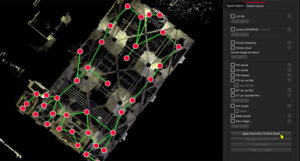
Leica Cyclone REGISTER 360 PLUS
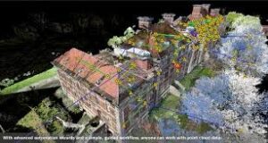
Leica Cyclone REGISTER 360 PLUS empowers users of any skill level to work smarter, deliver results more accurately, visualise in more detail and collaborate more effectively - placing users at the centre of their projects. From simple, guided workflows to automated registration, generate client-ready deliverables with the click of a button.
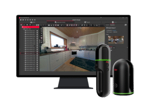
Leica Cyclone REGISTER 360 PLUS BLK Edition
Leica Cyclone 3DR is a powerful software solution that transforms point cloud data into accessible 3D models and actionable deliverables, leveraging automation and AI classification tools. Where most software will focus on a single workflow to create a specialised deliverable, Cyclone 3DR includes a range of adaptable tools for inspection, modelling and meshing that can be leveraged to create an assortment of 3D deliverables and reports.
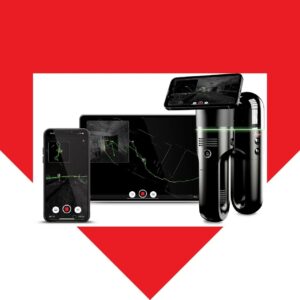
Leica Cyclone FIELD 360
We've overhauled Cyclone FIELD 360, featuring a faster, more intuitive interface that boosts productivity for users working in the field. Learn more about the update and learn how it will benefit you in our Expert Insight.
Leica Cyclone 3DR
Leica Cyclone REGISTER 360 PLUS empowers users of any skill level to work smarter, deliver results more accurately, visualise in more detail and collaborate more effectively - placing users at the centre of their projects. From simple, guided workflows to automated registration, generate client-ready deliverables with the click of a button.
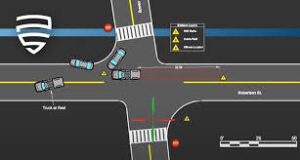
Leica Map360
Leica Map360, part of the Leica Geosystems Incident Mapping Suite, is a crash and crime drawing software solution that lets users import, process, analyse, visualise and create court ready deliverables. Map360 provides crash and crime reconstructionist with multiple user interfaces for all skill levels and easy to use tools to visually communicate a scene and critical evidence. Import scenes of any size into Map360 from a wide range of sensors such as laser scanners, total stations and GNSS, to produce accurate 2D or 3D diagrams and animations.
Leica CloudWorx for AutoCAD
Leica CloudWorx for AutoCAD is the most efficient and popular plug-in software for using as-built point cloud data – captured by laser scanners – directly within AutoCAD.

Leica CloudWorx for Revit
Leica CloudWorx for Revit is a breakthrough plug-in for efficiently using rich as-built point cloud data, captured by laser scanners, directly within Revit for better BIM modelling of existing buildings. This is useful for a wide range of BIM activities including retrofit design, construction and operations, and lifecycle asset management of the building. It provides a virtual visit to the site within Revit with a complete view of the captured reality.

Leica CloudWorx for Navisworks
Leica CloudWorx lets users efficiently visualise and process large point cloud data sets as a virtual as-built model, check proposed designs against existing conditions, perform critical construction & fabrication QA, and more… all directly within Navisworks.

Leica CloudWorx for Bentley
Leica CloudWorx for Bentley is the most efficient and popular plug-in software for using as-built point cloud data – captured by laser scanners – directly within Bentley MicroStation, AECOsim Building Designer and OpenBuildings Designer.
Leica CloudWorx for 3DReshaper
Leica CloudWorx for 3DReshaper brings a new level of productivity to the best-in-class meshing solution from Hexagon. Go from processed point cloud to a refined mesh with just a few clicks. Leica JetStream users gain the added benefit of seamless data transfer, unparalleled point cloud productivity and streamlined collaboration within 3DReshaper with no import/export delays.

Leica CloudWorx Ultimate
Unlimited in every sense. Handle projects and point clouds of any size, across all supported CAD systems to create deliverables more simply and deliver projects more efficiently to clients and stakeholders - all with a single, ultimate license.